
I'm looking for...
Close

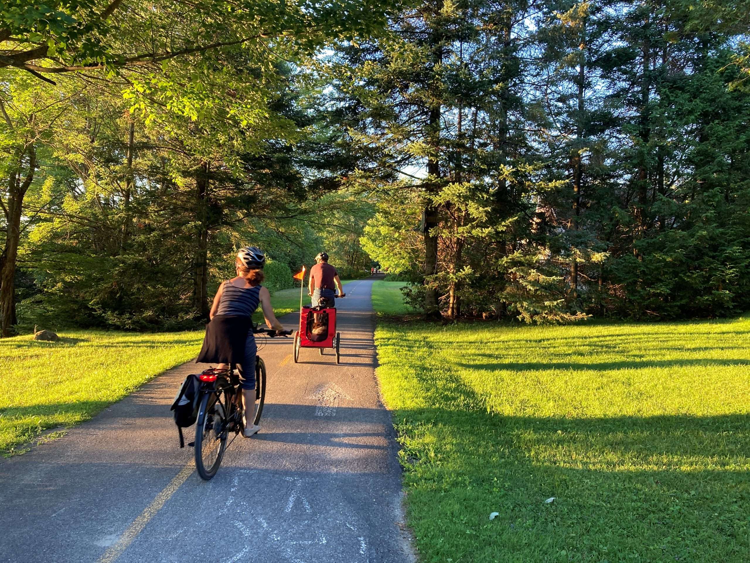
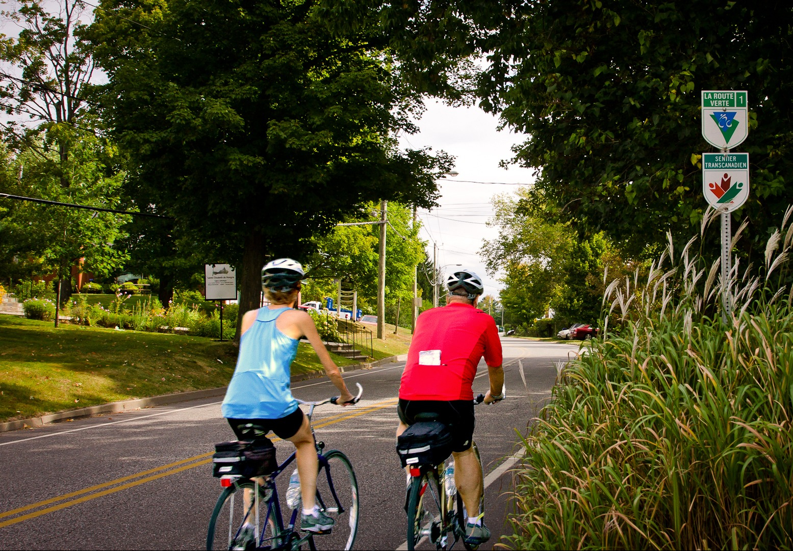
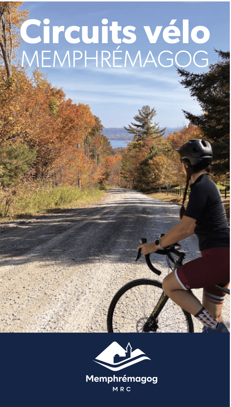
Ready to explore Memphremagog in a new way? Whether you’re a fan of short getaways or long cycling adventures, the region offers a network of looped routes that take you through all 17 municipalities. With picturesque landscapes, sparkling lakes, and delicious pit stops along the way, each route promises a unique experience. Hop on your bike and let these 7 must-try circuits lead you on an unforgettable two-wheeled adventure!
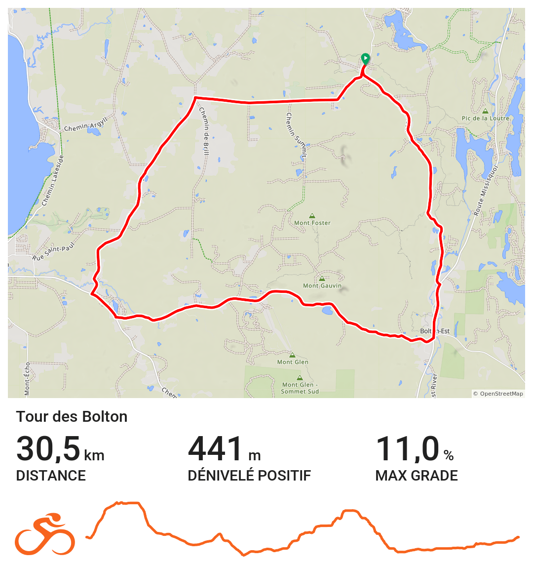
Suggested departure: Municipal Park (15 du Parc Street, Saint-Étienne-de-Bolton)
Difficulty level: Intermediate
Distance: 31 km
Elevation gain: 441 m
Paved surface: 9.5 km
Gravel surface: 21 km
Ride through the heart of Memphremagog’s picturesque landscapes. This 31-kilometre route, following scenic gravel roads perfect for cycling, showcases the region’s unique charm with its rich natural and architectural heritage.
Relax and unwind:
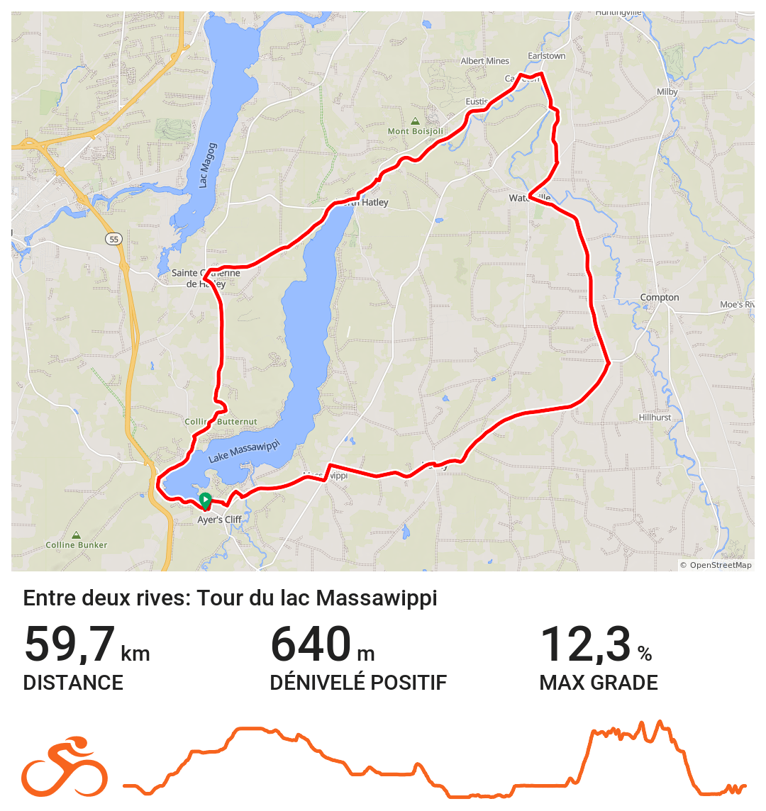
Suggested departure: Brown’s Hill parking lot (Brown’s Hill Road, Ayer’s Cliff)
Difficulty level: Experienced
Distance: 60 km
Elevation gain: 640 m
Paved surface: 52 km
Gravel surface: 8 km
Starting from Ayer’s Cliff, this mostly paved route runs alongside Massawippi and Magog Lakes. Passing through the village of North Hatley with its English-style architecture, the Massawippi Route (a section of the Véloroute des Grandes-Fourches) offers picturesque landscapes along the river.
Take a break:
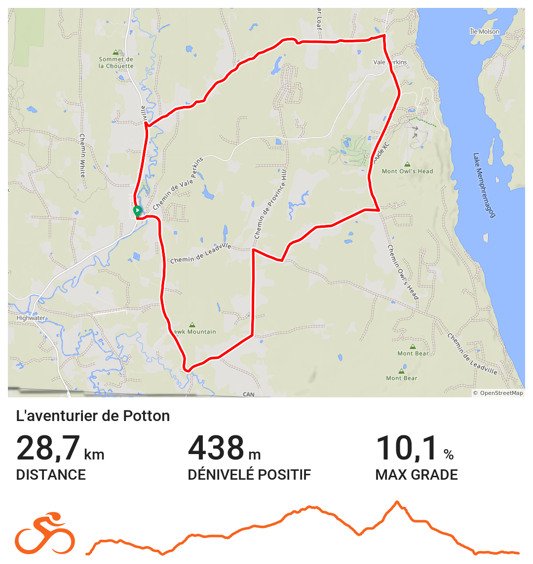
Suggested departure: Potton Township Tourist Office (291 Principale Street, Mansonville)
Difficulty level: Intermediate
Distance: 29 km
Elevation gain: 438 m
Paved surface: 8 km
Gravel surface: 21 km
Here’s a golden opportunity to take in the most beautiful landscapes of the Township of Potton! Gravel enthusiasts, this route offers breathtaking 360-degree views of the surrounding mountains. End your ride in Mansonville, where you can stock up on local goodies and enjoy them while admiring the charming century-old round barn at the heart of this lively village.
Make a stop:
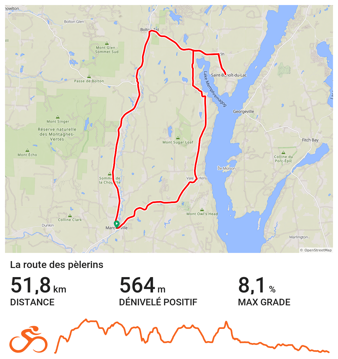
Suggested departure: Potton Township Tourist Office (291 Principale Street, Mansonville)
Difficulty level: Experienced
Distance: 52 km
Elevation gain: 565 m
Paved surface: 52 km
Embark on an extraordinary 52-kilometre cycling adventure along a paved route that unveils the breathtaking beauty of the Eastern Townships. With Lake Memphremagog, the majestic Orford and Owl’s Head Mountains, and the serene Abbey of Saint-Benoît-du-Lac serving as your backdrop, this iconic tour of the Memphremagog MRC is brimming with local gems that will tantalize your senses and leave you savouring every moment.
Take the time to visit:
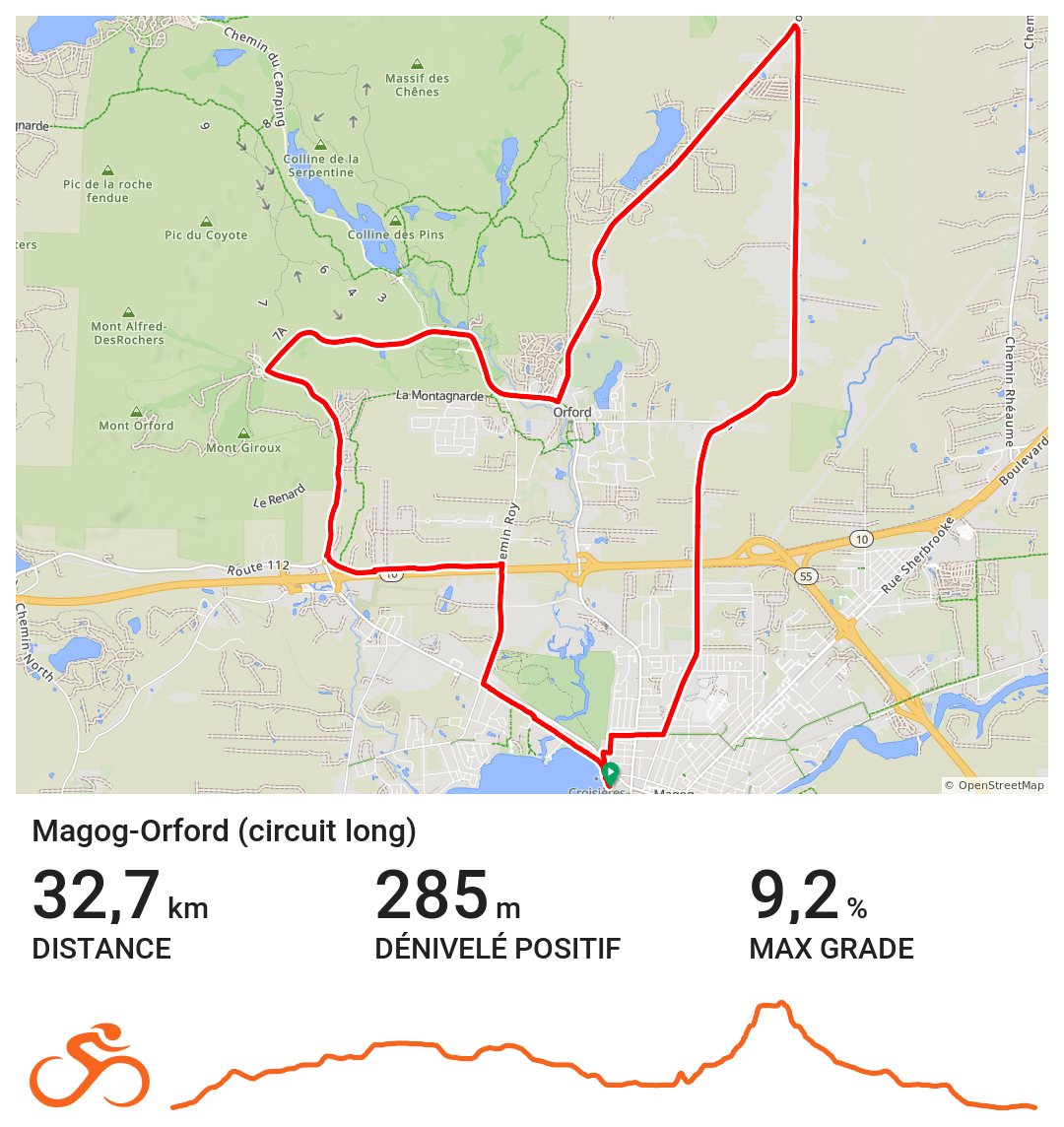
Suggested departure: Pointe Merry Park, Magog
Difficulty level: Intermediate
Distance: 32 km (possibility of a 23 km loop)
Elevation gain: 285 m
Paved surface: 31 km
Gravel surface: 1 km
This is one of the most popular cycling routes in the area. From the head of Lake Memphremagog to Mount Orford, this hilly route showcases the region’s vibrant colours, with many local producers and artisans along the way. If you’re up for it, take a detour via rang 13 for one of the best viewpoints of the mountain.
Quench your thirst:
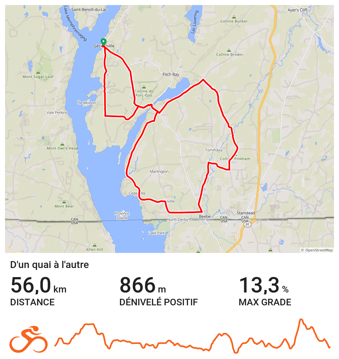
Suggested departure: Georgeville wharf (Copp Square, Georgeville)
Difficulty level: Experienced
Distance: 56 km (possibility of a 37 km loop)
Elevation gain: 861 m
Paved surface: 13 km
Gravel surface: 43 km
This 56-kilometre gravel route stands out as one of the most beautiful in the region. From the Georgeville dock to the Cedarville dock (Ogden), this figure-eight loop will challenge you with its climbs along the shores of Lake Memphremagog. Don’t worry, your efforts will be rewarded with stunning views and plenty of attractions along the way. If you want to save your legs, start in Stanstead and just take the second loop!
Stretch your legs:
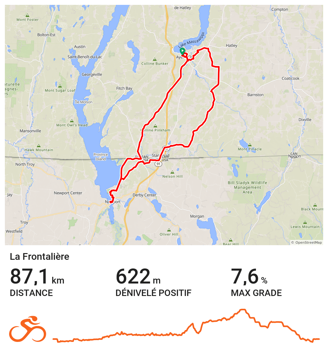
Suggested departure: Brown’s Hill parking lot (Brown’s Hill Road, Ayer’s Cliff)
Difficulty level: Intermediate
Distance: 87 km (possibility of a 50 km loop)
Elevation gain: 622 m
Paved surface: 42 km
Gravel surface: 45 km
Pedal your way through an ambitious 87-kilometre route connecting Ayer’s Cliff to Newport (Vermont). Passing by the Tomifobia Nature Trail, an amazing natural spot, this circuit offers a unique view of Memphremagog on the other side of the border. Important note: make sure you have your passport with you. For a shorter 50-kilometre version, take the Stanstead bike path and Fairfax Road. No passport is required for this route.
Get some rest:

La Bouffée d’Air
Embark on an unforgettable adventure and discover the captivating beauty of Potton Township with La Bouffée d’air‘s electric bike rentals. These eco-friendly bicycles provide a fun and effortless way to explore the region’s scenic routes, offering the autonomy of up to 85 kilometres per charge.
362, Mansonville road, Mansonville (Quebec) J0E 1X0
Price list
Vie de Plein air
Explore the scenic trails and picturesque landscapes of Magog and its surroundings with Vie de Plein Air‘s diverse selection of rental bikes. Whether you prefer the comfort of a hybrid bike, the power of an e-bike, the thrill of a fatbike, or the fun of a quadricycle, Vie de Plein air has the perfect ride for you.
55, Cabana Street, Magog (Quebec) J1X 2C4
Price list

Bienvenue cyclistes!
Easily identify cyclist-friendly accommodations and campsites with our “Bienvenue cyclistes!” certification. This certification ensures that these establishments cater to the specific needs of cyclists, providing the services and amenities you need for a comfortable and enjoyable stay.
More details here
“Bienvenue cyclistes!” accommodations in Memphremagog:
Fièrement vélo!
When you’re exploring the beautiful region by bike, look for the “Fièrement vélo!” certification to identify businesses that are committed to supporting cyclists. These establishments go the extra mile to ensure you have a smooth and enjoyable ride.
More details here
‘“Fièrement vélo!” shops in Memphremagog: